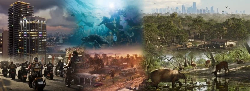
The useful way to read GTA 6's Leonida is not as a one-to-one copy of Florida. It is a compressed, fictional travel map: Vice City supplies the dense, neon-heavy urban core, while the Keys, wetlands, rural communities, ports, and less-polished Gulf-side towns give the wider state its shape. Rockstar's official material confirms that the game reaches beyond Vice City into Leonida, but it does not verify every fan-made building match or exact real-world measurement. 1 2
The current official release plan remains November 19, 2026, on PlayStation 5 and Xbox Series X|S. GTA VI has not released yet. Take-Two's SEC-filed lineup repeats those platforms and date; it does not list a PC version in that lineup. 3
Leonida is Florida-shaped, not Florida-recreated
Rockstar's public description calls Leonida home to “the neon-soaked streets of Vice City and beyond.” Its character material places Jason in the Keys and frames the story as a conspiracy stretching across the state. Those are confirmed setting and story details. They establish the scale of the fiction, not a promise that every road, tower, or county boundary matches a real map. 1 2
That distinction matters for players studying trailers. A recognizable silhouette can be a design reference without being a literal replica. Rockstar can move a port closer to a skyline, shorten a bridge, or combine several neighborhoods into one playable district while preserving the feeling of South Florida. The result should be judged by how well it communicates place and travel, not by whether it passes as a survey map.
Vice City: the waterfront explains the visual language
Miami's real waterfront is a meeting point for high-rise districts, airports, cruise infrastructure, entertainment, and heavy road traffic. PortMiami describes itself as both the “Cruise Capital of the World” and the “Cargo Gateway of the Americas,” while Miami International Airport connects South Florida to a broad international network. 5 6
That context helps explain why Vice City can feel larger than a collection of nightlife streets. In gameplay terms, an airport, port, downtown skyline, beaches, and industrial edges create different reasons to cross the city. In visual terms, they let the game shift quickly between tourism, commerce, wealth, and crime without leaving the same regional identity.
Claims that a particular fictional arena, hotel, apartment, or skyscraper is an exact renamed version of one real building remain visual analysis unless Rockstar confirms the connection. The official pages cited here establish Leonida and Vice City's broad setting; they do not certify every individual landmark comparison.
The Keys: geography becomes gameplay space
The Florida Keys are not simply more beach. They are a chain of islands extending from South Florida into the sea, with routes shaped by bridges, shallow water, boating, and limited land. The National Park Service's Biscayne material describes the Keys on the horizon from South Florida and explains how the island chain relates to Biscayne Bay. 9
Rockstar's official character page places Jason in the Keys, making the region part of the game's story world rather than a decorative postcard. 2 That suggests a useful reading of the Leonida Keys: expect a change in pace and navigation logic. Boats, bridges, narrow approaches, and small settlements can make distance feel different from a straight highway run through Vice City.
The exact layout is still unknown. Any claim that a particular trailer bridge is definitively the Seven Mile Bridge, or that the in-game Keys preserve real distances, should be treated as interpretation until Rockstar supplies a map or the game is playable.
Grasslands and wetlands: why the River of Grass comparison works
The Everglades comparison is stronger at the ecosystem level than at the landmark level. The National Park Service describes the Everglades as a subtropical “River of Grass,” with shallow water moving through sawgrass toward mangrove estuaries. It also identifies freshwater habitats, hardwood hammocks, saltwater areas, cypress swamps, sawgrass marshes, mangrove forests, and pine forests. 7
A second NPS guide explains that the phrase refers to slow shallow sheetflow across South Florida and notes that fire and seasonal flooding shape the grasslands. 8 Those details explain what a believable Leonida wetland needs to communicate: low elevation, open sightlines, water channels, mangroves, wildlife, changing fire and flood conditions, and movement that is not driven by skyscrapers.
The implication is not that every swamp vista is a literal Everglades recreation. Leonida can borrow the region's ecological rules while using GTA's own roads, missions, characters, and satire.
Rural Florida is part of the identity, not map filler
The Florida comparison works because the state is visually uneven. A neon beachfront, a working port, sugar-growing country, roadside commerce, island communities, and wetlands can all belong to the same fictional state. That contrast gives Leonida more narrative range than a city-only Vice City remake.
For players, watch how transitions are handled. The most revealing moments may be the roads between headline locations: where towers give way to low-rise businesses, where a highway becomes a causeway, or where dry fields meet standing water. Those edges are where a regional map communicates its logic.
Specific real-world inspirations for individual buildings remain interpretive. Exact map dimensions, one-to-one road geometry, final playable boundaries, and any future PC plan are not established by the sources cited here.
When reviewing new official footage, compare regions by function rather than by name. Ask whether a location is a city center, a tourist strip, a working port, a rural production zone, an island route, or a wetland crossing. That gives a better sense of how Leonida may be navigated than a checklist of alleged real-world lookalikes.